
Meteorologists are warning that the heavy rain that moved through the Pittsburgh area Saturday night may cause some ‘flash freezing’ on roadways Sunday.
Temperatures are expected to quickly plummet into the teens early Sunday. Gusting winds between 15 and 25 mph could push the wind chill value below 0.
Shannon Hefferan, a meteorologist with the National Weather Service in Pittsburgh, said the region could be looking at a "flash freeze" late in the morning, turning damp roads and sidewalks into sheets of ice.
"It's going to be an interesting event for people trying to get on the road or go to church in the morning," Ms. Hefferan said. "It'll be kind of a black ice situation, which is more dangerous than just getting snow."
Having escaped the wrath of a major snowstorm, the Pittsburgh area was still forecast to get some snow — 1 to 2 inches for the metro area and 4 inches in outlying areas — through Sunday morning.
A winter weather advisory has been issued for Allegheny County as well as Washington and Westmoreland counties through 10 a.m. Sunday. Areas north of Pittsburgh — Butler, Beaver, Lawrence and Armstrong counties — remain under a winter storm warning.
Read More
The National Weather Service scaled back earlier weekend forecasts after the storm’s track moved northward.
Although overall snow totals will clearly be lower than initially anticipated for the southern half of our region, a changeover to snow *is* still expected late tonight as much colder air arrives on the backside of the low pressure system. pic.twitter.com/YLCjm49d3s
— NWS Pittsburgh (@NWSPittsburgh) January 20, 2019
Ms. Hefferan said Saturday evening that the makeup of the storm was difficult to predict because different models showed contrasting results for which direction the freezing air would travel.
"It was really hard to decipher where that freezing line was going to set up," Ms. Hefferan said. "We've been trying to stress hard -- especially in the Pittsburgh region -- you might not see what you expect."
Here's our forecast for additional snowfall totals overnight: pic.twitter.com/guCRo26Ayv
— NWS Pittsburgh (@NWSPittsburgh) January 20, 2019
The change in forecast prompted PennDOT to lift speed restrictions and a ban on commercial vehicles on most highways across the state. The ban remains in effect on some interstates, the Pennsylvania Turnpike’s northeast extension, as well as the U.S. 22 expressway in the Lehigh Valley and the Pennsylvania Route 33 expressway in Northampton and Monroe counties.
A 45-mph speed restriction remains in place on I-80 from the Ohio State line to I-99, as well as I-376 in Mercer and Lawrence counties. The speed restriction is also in place on I-90, I-86, and I-79 from I-90 to I-80.
Butler County, much of Beaver County and areas farther north of the city, especially near the Interstate 80 corridor, could see up to a foot of snow.
State officials urged motorists to use caution during the storm, postpone travel if possible, reduce speeds and be aware of the potential for rapidly changing weather and roadway conditions.
“We could see snow, sleet, ice and, by Monday, extremely cold temperatures,” Gov. Tom Wolf said Friday. “This storm has the potential to deliver every, every winter weather option that Mother Nature has.”
By Monday morning, dangerously low wind chills are expected across portions of the Plains and East as arctic air filters through in the wake of the snowstorm. Temperatures will be the lowest so far this winter in some locales. Dress in layers if you must venture outside. pic.twitter.com/7IIh7sEouS
— NWS WPC (@NWSWPC) January 19, 2019
Last winter in Pennsylvania, according to the governor’s office, preliminary data showed 440 crashes resulting in 221 injuries on snowy, slushy or ice-covered roadways in which aggressive driving was a factor.
Motorists can check 511PA.com online for the latest travel conditions across the state. Users can also see plow truck statuses and travel alerts along specific routes using the “Check My Route” tool.
Port Authority will have extra maintenance crews working to handle any storm-related service issues. On Monday, the transit service will be operating on its usual weekday schedule.
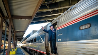
Amtrak is modifying service in the Northeast and Midwest because of winter storms moving through the region, and the rail line has canceled several trains scheduled to run Sunday in anticipation of the storm.
On the Keystone service, which goes from New York to Philadelphia to Harrisburg, trains 662, 664, 672, 661, 667 and 671 are canceled. On the Pennsylvanian service, which goes from New York to Philadelphia to Harrisburg to Pittsburgh, trains 42 and 43 are canceled.
All weekend events scheduled in Pittsburgh Public Schools were canceled.
Community College of Allegheny County campuses, centers and off-campus locations are closed Sunday, officials said. The college, which already was to be off Monday to observe the Martin Luther King Jr. holiday, will reopen Tuesday morning.
Monday may be the coldest day so far this winter, with a high in the teens and a projected low of 4 degrees. Tuesday morning will also have temperatures in the single digits, but it should rise fairly rapidly into the 30s.


Comments
Welcome to Post-Gazette subscriber-only commenting community. Please review our community guidelines.