Doug Oster, Post-Gazette
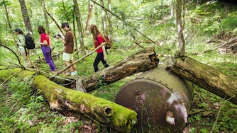
A view of the Pennsylvania Grand Canyon from Gillespie Point is a reward for these hikers. Well-illustrated maps of most of the state's parks and trails help hikers find the best vistas.
Click photo for larger image.
If there is any interval during the outdoorsman's year that can be dubbed "down time," it is the hot, muggy days of summer.
Except for those anglers willing to hike to the coldest headwaters, trout fishing is a month-old memory, hunting season is weeks away and even the bass and bluegill angling are not at their best. Except for picking blackberries and swimming in a cool river or lake, these weeks are an apt time to prepare for the year's other outdoor adventures.
Maps are a big part of outdoor preparation. Pennsylvania's outdoor enthusiasts may not have considered this, but we are fortunate here to have available a huge selection of accurate, durable, informative and even inspiring maps of our state forests, parks, game lands and canoe routes. Almost hard to believe is that these maps are free, or can be had at minimal cost. Some tax dollars are wisely spent.
It is true that the Internet has revolutionized the outdoorsman's quest for maps. With the right software, you can call up any point on Earth and view detailed representations of contour, elevation and everything else a conventional map delivers. Print it out, though, and you still have a fragile piece of paper, intended for use in an office, not on the trail.
Our Pennsylvania public land maps are durable and water-resistant. Somebody in Harrisburg knows it rains in the woods.
The value of our state's public land maps hit home a few days ago when I happened to travel near Laurel Ridge State Park on the border of Somerset and Fayette counties. If you have never been there, Laurel Ridge is worth a visit, especially now. The treetops are more 3,000 feet above sea level, the air is cool, the woods are deep and the occasional vistas over the flanking valleys are awesome.
I stopped in the office and picked up a free map/brochure. It's handy, like a map should be, but it's more. A few minutes perusing its foldable four square feet would prompt the most committed couch potato to get out and hit the trail, which is what Laurel Ridge is about.
It's a 70-mile-long hiking trail along some of the state's highest terrain, linking the Youghiogheny and Conemaugh rivers. The park's brochure features the conventional overhead perspective, but also gives a cross-section interpretation of the climbs and descents along the way. Arrayed with the maps are highway directions, wildlife viewing advice, hiking tips, nearby outdoor attractions, necessary details about camping reservations, parking, access points, attractive photos and some black bear wisdom. This map gives you the impression that the people who put it together love the outdoors as much as you do.
Laurel Ridge is a unique park, but maps of our other parks and state forests are just as inviting and useful. Excellent maps are also available for state forest wild and natural areas within larger state forests.
State game lands maps, while not so detailed, do give you the perspective you need to explore new places. There is a 50-cent fee for maps of the more than 300 game lands parcels.
You don't find this kind of resource everywhere. My mother-in-law lives in a rapidly growing metropolitan area in a nearby southern state. Not far from her home is a large state park of historic and natural significance.
I went there to hike and watch wetland wildlife on a recent visit. The map I got at the office was, from my Pennsylvania perspective, pathetic.
Upon my inquiry, the ranger pointed to a stack of photocopied white paper. The copied map's scale was so large it was useless, and the text was minimal, boring, but slightly threatening. You have to be strongly motivated to see that park to suffer through using its map. A casual visitor would find nothing on its surface inviting further engagement.
Readers who want to expand their outdoor horizons can find details on state parks and state forests at the Department of Conservation and Natural Resources' Web site: www.dcnr.state.pa.us.
Check out game lands information at www.pgc.state.pa.us. The Fish and Boat Commission has maps and brochures on water trails: www.fish.state.pa.us.
Pennsylvania stands out as a leader in publications regarding its public lands. The future of public access and healthy outdoor environments depends on the populace knowing and caring about nature. In that light, a good map is no small thing.
This story was originally published with images that are no longer available.



Comments
Welcome to Post-Gazette subscriber-only commenting community. Please review our community guidelines.